 01
01Rust-native runtimeOriginal brand artwork
 TasteGeo
TasteGeo
Rebuilding GeoServer compatibility in Rust.
A Rust-native geospatial server built by comparing existing OGC requests and operational behavior with a reference server.
01TasteGeo rebuilds the public behavior teams already depend on while making runtime, storage, and verification boundaries explicit.
WMS, WFS, WMTS, WCS, and REST contracts are compared at the public HTTP boundary.
Requests, responses, errorsA memory-safe native runtime targets predictable deployment without a JVM dependency.
Rust 2024, Axum, TokioProtocol code does not bind directly to PostGIS, GeoPackage, Shapefile, or GeoTIFF implementations.
Versioned capability boundariesRead-only analysis, semantic diffs, shadow traffic, and rollback gates support phased adoption.
Compare before cutoverThe same configuration contract and operating workflow target Linux, Windows, and macOS.
One server modelProduct, verification, documentation, and community routes are available in ten languages.
Locale-aware UI and metadataProtocol + store wall
Every core contract in the generated matrix is currently partial support under validation. This is a measured compatibility surface, not a completion claim.
Maps, feature info, and legends
Feature queries and transactions
Matrix sets and tile cache
Coverage subsets and output
Catalog and service configuration
Primary vector adapter
Portable SQLite datasets
Bounded vector ingestion
Raster and coverage store
Cloud-optimized raster target
We validate compatibility by preserving protocol semantics, errors, catalogs, and operational flows. This is not a declaration of complete compatibility with any product.
SERVICE=WMS
REQUEST=GetMap
VERSION=1.3.0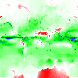
GeoServer is the mature reference with a broad Java extension ecosystem. TasteGeo is an independent Rust implementation under qualification, not a drop-in completion claim.
| Evaluation point | GeoServer | TasteGeo Server |
|---|---|---|
| Runtime | Java 17 or 21, packaged application or servlet container | Native Rust server target, release qualification in progress |
| Language safety model | Java managed memory and JVM garbage collection | Rust ownership and borrow checking, no GC in the default path |
| Operational resource model | Mature JVM heap, GC, and container tuning practices | Native binary and explicit memory lifetimes, workload validation in progress |
| Compatibility | Established OGC and operational behavior | Same-request semantic comparison against a reference server |
| Extensions | Large core, extension, and community module ecosystem | Versioned plugin boundaries with a deliberately limited surface today |
| Data stores | Broad, mature vector and raster integrations | Priority adapters are implemented and validated incrementally |
| Migration | Existing production configuration and data_dir | Read-only diagnosis, separate conversion, shadow traffic, rollback |
| License | GPL version 2 or later | GPL-2.0-or-later, independently developed |
GeoServer reference documentationRuntime Extensions License
Keep the clients. Move the runtime to Rust.
Workspace architecture
We fix dependency direction and verify public HTTP behavior. No storage engine or framework gets to define protocol semantics.
Protocol- and storage-independent values, parsers, coordinate systems, and observability boundaries.
geometrycrsfilterogc-commonconfigobservabilityCatalog, security, style, and versioned extension contracts live in one layer.
catalogsecuritydatastore-apistyleplugin-apiData access is isolated so protocol implementations never depend directly on a particular store.
store-postgisstore-geopackagestore-shapefilestore-geotiffOGC services and the administration API are assembled above rendering and cache layers.
rendertile-cachewmswfswmtswcsrest-apiThe server assembles boundaries; verification tools compare only public HTTP and fixtures.
servercompat-testsTasteGeo will publish results only after both servers run on the same hardware, datasets, request mix, warm-up policy, and correctness gates.
Public benchmarkMeasurement in preparation
Each run records the exact build, environment, dataset, concurrency, cache state, and semantic result. A faster incorrect response is a failed result.
Review verification evidenceResponse latency by OGC workload
Sustained requests per second
Time to first response byte
Processor cost at equal load
Resident memory and growth
Database pool pressure
No estimated or local-only values are presented as public performance claims.
TasteGeo separates local code-quality gates from external release qualification. Core contracts remain partial support under validation while final promotion is in progress.
Send the same request to the reference server and candidate, then normalize and compare semantics.
Captured output
We verified each fixture's content type and binary signature. Reference captures are never presented as candidate output.
Reference capture / image/png / 256 x 256
Original brand artwork / not test evidence

Reference capture / image/png / 256 x 256

Reference capture / image/png / 64 x 32
Sponsorship accelerates independent compatibility work, reproducible benchmarks, and release infrastructure while technical status remains public.
Add protocol cases, stores, clients, and regression fixtures.
Run controlled reference and candidate workloads on isolated hosts.
Support packaging, signing, documentation, and long-duration qualification.
TasteGeo builds reproducible comparisons and operational evidence before making completion claims.
Under development